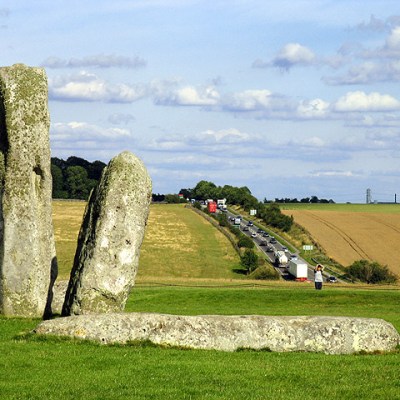
A report published last month has suggested the existence of a series of massive pits, forming a ring of about 2km in diameter around the late Neolithic henge enclosure at Durrington Walls in Wiltshire. The pit circle, described as the largest prehistoric structure found in Britain, was initially recognised as a series of anomalies during large-scale geophysical surveys – part of investigations known as the Stonehenge Hidden Landscape Project that began in 2010, led by Vincent Gaffney at the University of Bradford. These anomalies were found widely scattered across the landscape, but the eyes of the researchers were drawn to a group of 20 that seem to form a ragged circle concentric with the earthwork enclosure of Durrington Walls on the west side of the River Avon, to the northeast of Stonehenge. The report raises a number of interesting questions about how we visualise and understand huge prehistoric monuments.
Animation still showing the pit circle near Durrington. Courtesy University of Bradford

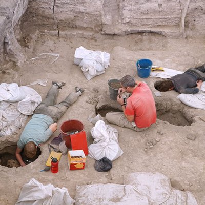
The pits are about 20m in diameter and up to 5m deep, as revealed by further geophysical surveys using ground-penetrating radar and then mechanical coring. Small quantities of struck flint, shell, and animal bone have been recovered from them, with the bone providing radiocarbon dates from about 2500 BC through to 1200 BC. Curiously, four of the pits were previously excavated by teams from Wessex Archaeology as part of quite separate development-led projects in advance of works for the Ministry of Defence at Larkhill and Durrington. This earlier work suggested that the features were of natural origin. As usual with hollows created by natural solutions, the upper fills have become compacted, trapping archaeological material in the accumulating matrix of soil and stone which here is mostly middle Bronze Age debris, dated to about 1500 BC.
Together, the pits appear to form an alluring pattern, with an interesting relationship to a known late Neolithic monument. But understanding what this pattern might mean requires a shift in the way we deal with archaeological evidence. The starting point here is the challenge posed by the massive datasets recovered from large-scale high-resolution geophysical surveys of the kind increasingly being used to explore familiar landscapes such as those around Stonehenge and Avebury. The data in these surveys reflects everything from single pits or postholes through to extensive and complex patterns of ditches forming enclosures, boundaries or field-systems. It can relate to anything that has happened in the area since the end of the last Ice Age, and in some cases even before that. Sampling and ground-truthing anomalies is an essential part of interpreting them – but simply picking out points and features that seem to form a pattern in otherwise quite random data is a dangerous game.
If we accept that the Durrington anomalies do constitute an integrated structure, its scale at 2km across should come as no surprise. The nearby Stonehenge Cursus is nearly 3km long; the Stanwell long mound that runs underneath Heathrow’s Terminal 5 is upwards of 3km long. At the top end of the scale is the gigantic Dorset Cursus (actually two set end to end) that clocks in at around 10km. Prehistoric people were just as capable as more recent communities of structuring, organising, and enhancing their world at a landscape scale. The great ceremonial centres of later Neolithic Britain were the designed landscapes of their age. These small-scale societies did not live in small-scale worlds.
The snag for us today is that it is hard to visualise these arrangements. There is nothing now to see on the surface, and in any case the landscape as a whole is quite different. What would it have felt like coming across one of the pits in the Durrington structure and realising that there are others leading the eye across the undulating chalklands? Virtual reality can help, but even with such tools it is difficult to capture the vastness.
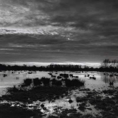
Aerial view of the proposed site of the Durrington Shafts monument, photographed in 2020. Photo: Dr Henry Chapman (University of Birmingham)

Approaching these monuments in the present day requires a change of mind-set. The Neolithic world was not like the modern one. The opposition between culture and nature that is such a feature of recent thinking, and a key element of positivist science since the 18th century, did not apply in the prehistoric world, when culture and nature appear to have been understood as a seamless whole. The fact that some of the pits in the Durrington structure were formed by geological processes does not preclude them from being part of a coherent meaningful monument. What the archaeologist Richard Bradley and others refer to as ‘found structures’ were sometimes incorporated into socially structured places. Ways of seeing and understanding the world back then would perhaps have had a more animistic quality, with all recognisable dimensions of the world understood as being in some sense alive and related to one another. People were connected with other entities, rather than somehow separate and discrete.
Seen in this way, the power of place was significant. Some places were very powerful indeed, perhaps frighteningly so, and needed to be controlled. Digging rings of pits around earlier powerful places began in around 3000 BC and grew in popularity through the early and middle Bronze Age to about 1200 BC. It was a tradition first recognised by Stuart Piggott and Richard Atkinson while working at Stonehenge in the 1950s; the so-called Y and Z holes encircling the stone structures are prime examples. Recent re-evaluations of the great bank and internal ditch that define Durrington Walls show that, as at many henge monuments across Britain, the earthworks were added towards the end of a long sequence of interventions that served to seal the interior off from the surrounding landscape. The proposed pit circle around Durrington Walls not only adds another dimension to our understanding of the landscape, but also accords with what we know of the way prehistoric people dealt with their past and the powerful forces around them.
Timothy Darvill is professor of archaeology at Bournemouth University.